Law enforcement proactive policing
When law enforcement is proactive about monitoring regulations, policies, and offenders in their municipalities, they make their day-to-day jobs easier. Data that informs about rules that are broken before harm is caused enables law enforcement workers to be more effective and efficient, and keeps communities safer.
Required data
Law enforcement data, which might include:
- Public business records
- Criminal record data
- Crime statistics
Procedure
The following searches are guidelines intended to help you get started. Depending on your data set, you might need to change field names or parameters. You can optimize the searches by specifying a time range.
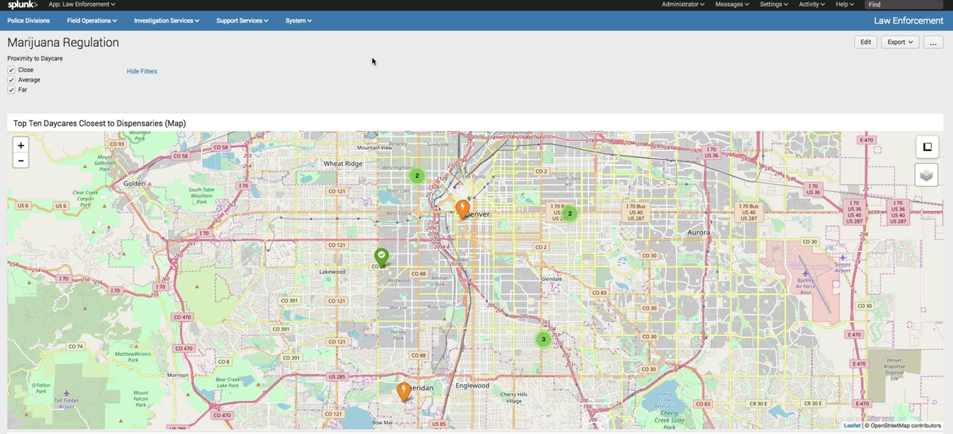
Public data sources on business regulations can be brought into the Splunk platform and reveal where zoning laws are being broken. For example, in Colorado, there must be a certain distance between child day care facilities and marijuana dispensaries. By combining those data sources with a mapping service in the Splunk platform, you can create a color-coded visualization that allows you to monitor for infractions.
| inputlookup top_ten_closest_dispensaries.csv
| rename "distance to closest dispensary(feet)" AS distance
| eval distance_to_daycare = case('distance' <=220, "Close", 'distance' >220 AND 'distance' <=500, "Average", 'distance' >=501, "Far")
| sort "distance"
| eval markerColor = case(like(distance_to_daycare, "%Close%"), "red", like(distance_to_daycare, "%Average%"), "orange", like(distance_to_daycare, "%Far%"), "green")
| eval icon = case(like(distance_to_daycare, "%Close%"), "exclamation-circle", like(distance_to_daycare, "%Average%"), "flash", like(distance_to_daycare, "%Far%"), "check-circle")
| eval description = "<b>"."Daycare: ".Daycare."</b><br>"."Dispensary: ".Dispensary."<br>"."Distance (in feet): ".distance ."<br>Streetview of Day Care<br><img src=https://maps.googleapis.com/maps/api/streetview?size=400x150&location=".latitude.",".longitude."&key=AIzaSyC8ll4E3CtzUnZ0YjjM93M9eeuxEJ1roTc >"
| search Dispensary=*
| where distance_to_daycare="Close" OR distance_to_daycare="Average" OR distance_to_daycare="Far"
| table "Day Care Type" Daycare "Daycare Address" Dispensary "Dispensary Address" "License Type" description distance "distance to closest dispensary(mi)" distance_to_daycare icon latitude longitude markerColor
For help creating map visualizations, try the Maps+ for Splunk app.
Next steps
Finally, you might be interested in other processes associated with the building a data-driven law enforcement strategy use case.